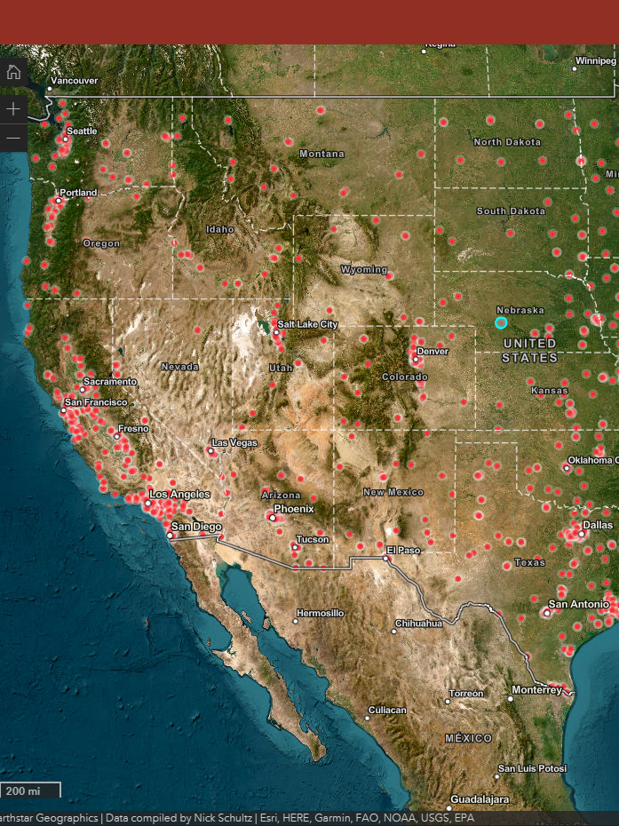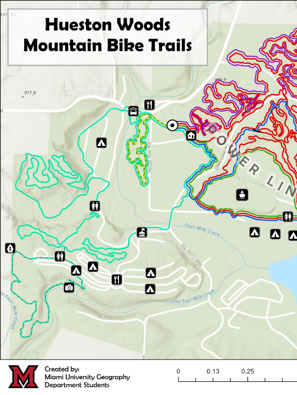
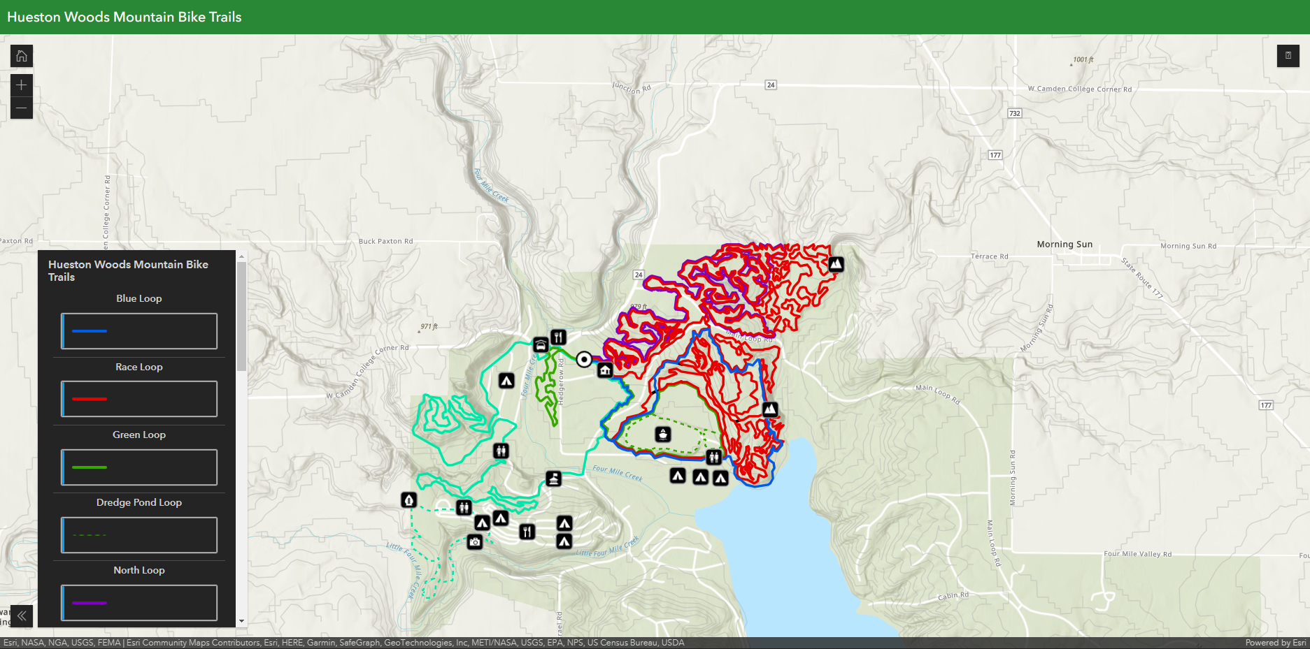
In the fall of 2022, I worked on a team of six to develop a new map for Hueston Woods Mountain Bike Trails. For this project, my group digitized all of the trails, stored and managed the data, developed a static map that is now on display at the trail, and developed a series of ArcGIS Online Web Maps.
For my portion of the project, I was responsible for the web maps. I developed all of the maps shown in this portfolio for the client. In addition to the development and management of the web maps, I also helped digitize the manage the trail data in ArcPro.
Interactive Map Final Product for Client
Click Here - This is an interactive map in which viewers can turn layers on or off, view pop ups with information that Hueston Woods requested regarding distance and elevation, and points of interest.
Other maps that I made for alternative views.
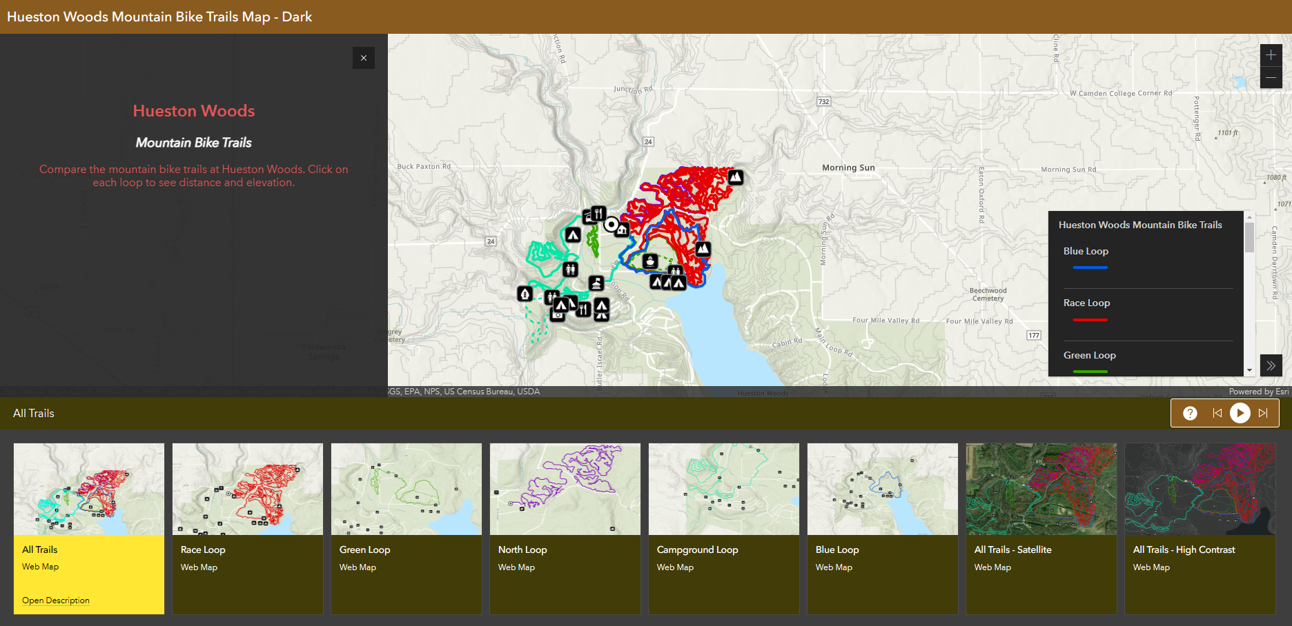
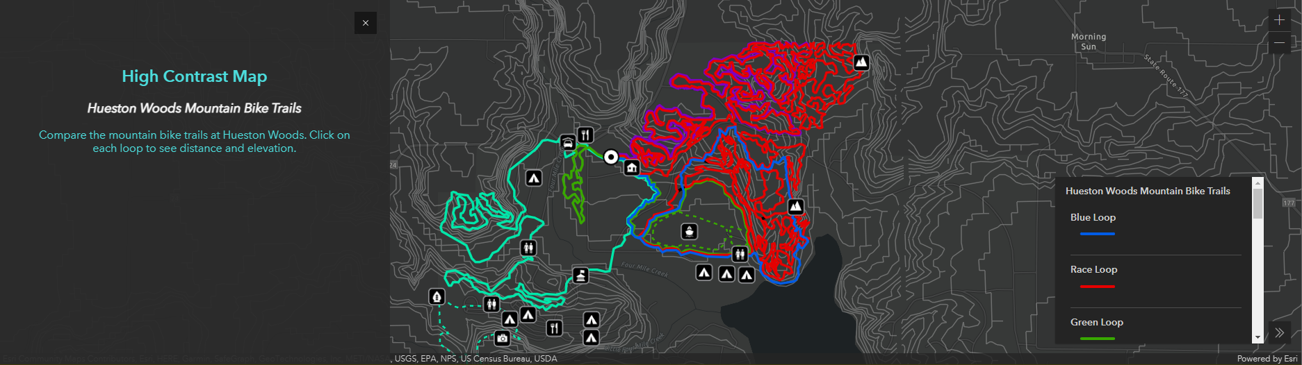
https://arcg.is/1TTvy5 - Dark mode comparison map
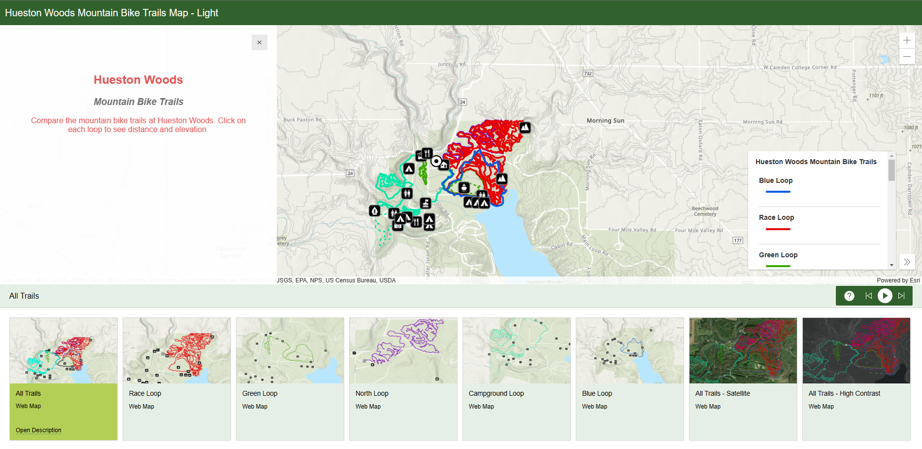
https://arcg.is/1DayTT0 - Light mode comparison map
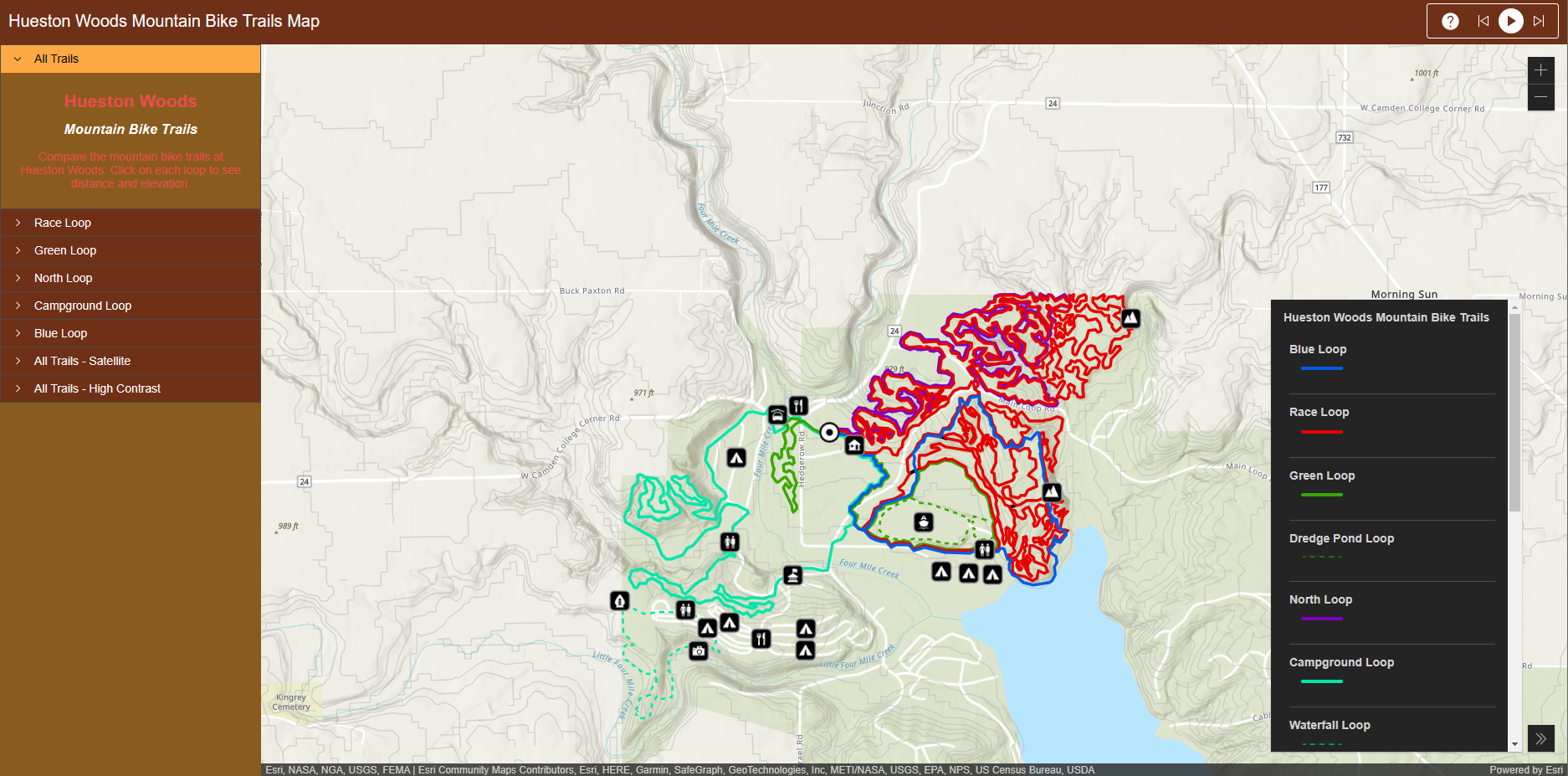
https://arcg.is/y0D4q - ‘Accordion’ comparison map
Inclusivitiy in Web Maps
Though it was not required by the client, I thought that it was important that the map be inclusive to those with visual impairments. For this reason, I developed an alternative high contrast view on the dark mode and light mode maps.